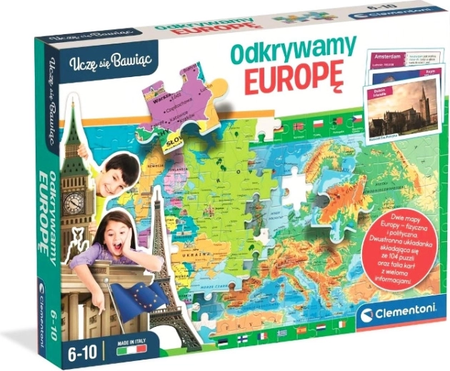
Explore Europe through play! This double-sided jigsaw shows a physical and political map of Europe, helping children learn the terrain, countries, borders, and their names. It also includes a card game with capital cities and interesting facts about population and area. A perfect blend of learning and fun that develops logic, memory, and geographic knowledge.
Geography has never been this fun. The double-sided puzzle offers a detailed physical map (mountain ranges, rivers, seas) and a political map (countries, borders, names), giving children a comprehensive picture of Europe. Thanks to clear, visually organized design, they can easily remember key information.
The box also includes a set of cards that lets players practice capital cities and discover facts about the population and area of each country. The game seamlessly connects learning with play and supports concentration, memory, spatial imagination, and critical thinking.
- 2 in 1: double-sided puzzle – physical and political map of Europe
- Card game: capital cities, population, and area of countries
- Skill development: logical thinking, memory, geographic knowledge
- Fun learning: ideal for home study and family play
Specifications
- Product type
- Educational puzzle and card game
- Theme
- Map of Europe – physical and political
- Box contents
- Double-sided puzzle, set of cards with information about countries and capital cities
- Content language
- European geography (names of countries, capitals, data on population and area)
- Recommended age
- School-age children (approx.)
- Educational benefits
- Develops geographic knowledge, memory, and logical thinking